The Moon Illusion
Have you ever noticed - I'll bet you have noticed, how large and striking the Moon appears when you suddenly spy it low in the horizon shortly after rising or just before setting? Have you ever been curious as to why this is? Did you ever wonder how it happens, and how you can prepare beforehand to catch such an amazing sight? Let's take a cursory look at the science and timing behind this phenomenon so that we can better understand, appreciate, and reliably experience that fat ol' Moon hitting your eye like a big pizza pie.
That's Amore!
Some basic facts and stats: The Moon interacts with Earth, like most physical objects within the Newtonian mechanical framework, with extreme regularity and precise predictability. So we have old Lunar calendars, a fairly long history of predictions of Lunar eclipses, and ancient stories involving the anthropomorphized or pareidolic images imagined upon the light vs. dark features on the near side of the Moon's surface (e.g. the man in the Moon, the rabbit in the Moon, etc.).
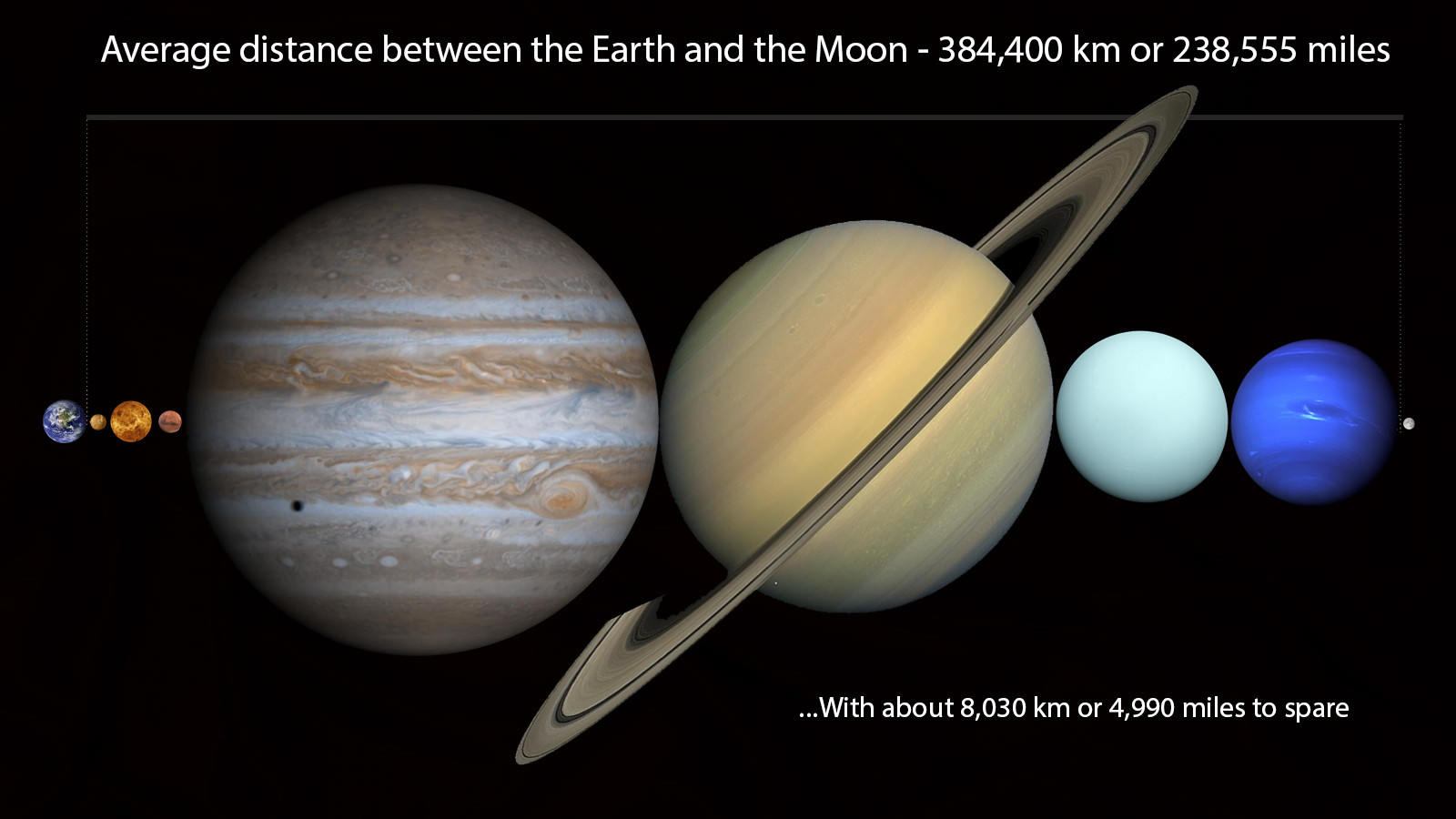
From modern Astronomy we have gleaned much more: the average distance from Earth to the Moon is 384,400km or 238,900mi - closer at perigee and farther away at apogee. The Moon is about 400x smaller than the Sun, but about 400x closer which is why we have 1 to 1 Solar eclipses. The Moon is also moving away from Earth at a rate of about 5in. per year so in the future eclipses won't be as cool. The Moon is tidally locked to Earth and therefore shows the same side or face to us each day/night - there is no "Dark side of the Moon" unless you are referring to the far side during a full Moon, the near side during a new Moon, or any combination of the Sun's position in relation to the Moon's opposing side during its monthly phases as seen from Earth. The full Moon always rises around sunset and sets around sunrise (that's why its full disk is lit), the new Moon is invisible (because its far side is lit) and only "returns" to the sky after a day or two as the waxing crescent and sets just after sunset, later and later each night.
The "SuperMoon" is a term coined by astrologer Richard Nolle in 1979 and basically means any "new or full Moon that occurs at or past 90% of its closest approach in a given orbit" (from Wikipedia). Each full Moon has a name and you can find them all HERE (BTW June's full Moon is the Honey Moon which is why, as many weddings happen in June, the vacation period enjoyed by the bride and groom directly after shares the same name). The "Blood Moon" is a media term given to the full Moon during an eclipse when it takes on a red, orange, or ruddy hue - this is due to the collective sunrises and sunsets all around the Earth (which lies directly in between the Sun and the Moon) passing through the Earth's atmosphere and then projected onto the properly aligned and therefore eclipsed full Moon's face (pretty damn epic in my opinion). The actual Blood Moon is one of the names given to the full Moon in the month of October.
The dark parts of the Moon are called Mare (Latin for Sea) and are low lying plains of solidified Basaltic lava. The lighter toned upper crust is where we find most of the impact craters, mountain ranges, ridges, rilles, and valleys which is covered by a fine dust called "regolith" that, because there is no wind or water erosion to smooth the dust particles' edges, is extremely sharp and jagged and clings to EVERYTHING. 12 Americans males have stepped foot on the Moon and the American flag left there by the astronauts of Apollo 11 has since been bleached white by solar radiation. You cannot see any evidence of the Moon landings from any Earth or space based telescopes (due to limits of resolution and just how far away the Moon is) except for the images captured by the LUNAR RECONNAISSANCE ORBITER of which there are many. Speaking of distance, it is possible to fit all of the planets in the solar system side by side (tilting Saturn to cancel out its rings) in the distance between the Earth and the Moon (from Reddit). I think you can just squeeze in Pluto as well. The Moon is about 4.5 Billion years old and was formed (according to prevailing theory) when a Mars-sized object named Theia impacted our planet and sent blasted material into orbit which slowly accreted into our only natural satellite. The Moon's official name is The Moon.
That should suffice for now. Back to size, perspective, and illusion.
There are a few competing hypotheses as to how the Moon illusion works its magic upon the human eye or brain, and indeed whether it is a true optical illusion or merely a cerebral or intellectual effect. The debate dates all the way back to the 4th Century BCE when philosophers, Astronomers, and mathematicians like Aristotle and later, Cleomedes and Ptolemy were beginning to describe optics, refraction, and graphical perspective. You may have heard about this particular historical episode in your high school art class as it was boiled down to the fact that perspective in art was basically 'discovered'. Before this time "paintings and drawings typically sized many objects and characters hierarchically according to their spiritual or thematic importance, not their distance from the viewer" (from Wikipedia). There was no use of vanishing points and hence no sense of 3D perspective, at least systematically, until roughly the 1400's during the so-called Renaissance period in Europe.
But much before that, Aristotle maintained that there was a mysterious magnification effect in play which made the Moon literally appear larger upon the horizon as it was viewed through more and more of the Earth's thick atmosphere. This hypothesis is easily disproven by holding out your thumb or a coin at arm's length at different times throughout an evening revealing the Moon's (mostly) constant apparent size depending on its point in its orbit. Somewhat similarly, in Ptolemy's Opticks there was an attempt to explain the illusion through atmospheric refraction (a change in the direction of a light wave as it passes through a different medium like a straw that looks bent in a glass of water), but this too was disputed and never gained popularity.
The two main arguments still in competition are the Apparent Distance and the Relative Size hypotheses, and both slightly pick up where the other leaves off. Apparent Distance brings into account the perception of graphical perspective touched on earlier and states that objects on the horizon are automatically perceived by the brain as farther away than when viewed overhead. We view the horizon Moon in context with other visual cues such as distant trees, buildings, and landscape features which, by contrast, seems farther and thus appears larger than when viewed at zenith, absent any visual cues (see the Ponzo Illusion). To add to this effect (which so far sounds closer to the Relative Size hypothesis), we expect the Moon, like other objects, to diminish in size as it recedes towards the horizon (along the narrowing vanishing lines as parallels converge to a point); as it does not, the illusion becomes more and more striking.

The Relative Size camp emphasizes the relative size of nearby visual cues to account for the illusion. When on the horizon the Moon is seen in comparison to smaller objects, fine in detail and of more familiar dimensions.

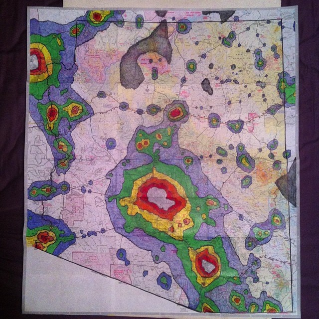
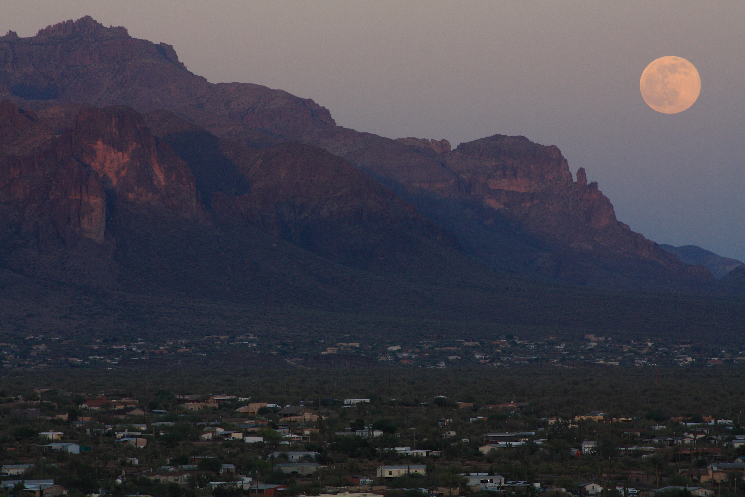
Shown here (above) in the classic Ebbinghaus Illusion, both circles at the center are the exact same size, yet appear larger or smaller in the context of the circles surrounding them. Now have a look at these three images (below) all taken by me on the same evening from two different locations and at different focal lengths as the two or three day old Moon was setting over Phoenix, Arizona.


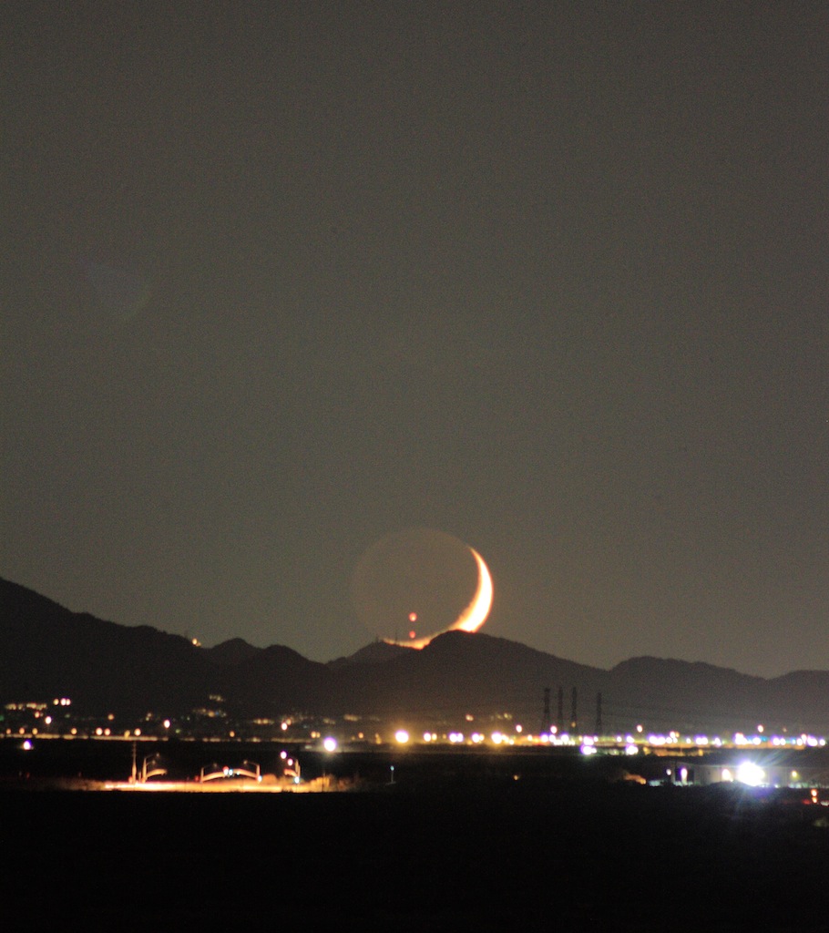
With the right equipment and know-how, and with enough planning (or luck I suppose) the landscape astrophotographer can even create seemingly impossible images such as this image from a timelapse video produced by artist Mark Gee who had to write up a full explanation of the shot after critics (including me) accused him of not labelling what must clearly be a composite image:

It doesn't help that he lives and shoots in the Southern Hemisphere making this Moon appear slightly upside down or sideways to those in northern latitudes. This is a perfect example of what can be accomplished with a forced perspective combining a long focal length (1300mm) and a warped perspective of the subject or foreground (the people on the hill are 2.1km away).
The Moon's orbit, position, and phases can be extremely confounding to the novice, but its a pretty shallow learning curve to begin to understand the Earth-Moon system, its fluctuations and phases, and how to prepare yourself throughout the months and seasons to best observe her as you attune your mind to the shifting realms of Earth's night sky.
Relevant (iOS) apps: GoSkyWatch, Star Walk, Sky Week +, Phases of the Moon, The Photographer's Ephemeris